Organic Maps・Offline Map & GPS
- 3.8
- Rating
- 5.00M
- Installs
- Free
- Price

 Analysis by App-foxy
I came away from Organic Maps with the feeling that it is built for people who would rather prepare a trip once than depend on a constant mobile connection. It is a free Maps & Navigation app from Organic Maps, focused on downloadable maps, GPS guidance, hiking, cycling, and travel. That sounds straightforward, but the difference becomes clear when a journey moves beyond dependable coverage or when a phone needs to conserve its connection and battery.
My experience with it is less about flashy presentation and more about confidence. I can look at a route before leaving, keep the relevant map available offline, and use the phone as a navigation tool without treating a weak signal as an emergency. It is not the universal replacement for every map service, though. Its strengths are independence, clarity, and outdoor usefulness; its compromises appear when I need constantly changing traffic information, highly detailed business data, or the broadest possible live-search experience.
How Organic Maps feels during real navigation
I find the most useful way to judge navigation is to notice what I can still do when the day stops going to plan. In this section, I focus on how a downloaded map changes ordinary choices—checking a detour, getting oriented after a missed turn, or deciding whether to keep moving—before turning to the practical trade-offs that shape a longer trip.
You May Also Like

 Blood Strike: 2.5 Anniversary
Blood Strike’s Loadouts Turn Every Drop Into a Tactical Gamble
A close look at Blood Strike’s custom loadouts: how fast access to signature weapons reshapes its battle royale rhythm, rewards preparation, and narrows the gap between fights.

 Pandora - Music & Podcasts
Pandora’s Music Is Easy to Start, but Harder to Recover
Pandora’s strength is its low-effort path from a seed to a station. Its weak spot is how much confidence it asks you to place in connection, setup, and quiet recovery.

 8 Ball Pool
 Is Built on Rivalries, Rematches, and Routine
A close look at the rivalries, rematches, shared routines, and unanswered safety questions that turn a quick pool match into a persistent mobile community.

 Samsung Music
’s Quiet Strength Is Playing What You Already Own
Its reach comes less from spectacle than from dependable access to a personal library. That simplicity is both the app’s strongest retention engine and its ceiling.

 AccuWeather: Weather Radar
AccuWeather Review: A Quick, Clear Forecast for Everyday Decisions
For everyday plans, the best forecast is the one you can understand quickly. AccuWeather makes rain timing, radar, and local conditions easy to act on, with a few trade-offs.

 Hill Climb Racing
Why Hill Climb Racing Still Turns Crashes Into One More Run
A tiny car, a bumpy hill and one more upgrade: Hill Climb Racing keeps resurfacing because its simple chaos makes every near-miss feel personal.
More From Our News Desk



Quick planning without a crowded interface
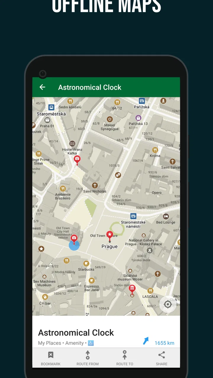
The first thing I notice when opening the app is how naturally it suits deliberate planning. I can browse an area, inspect roads and paths, and decide what to download before setting out. That workflow matters because offline navigation is only genuinely useful when preparation is simple enough that I will actually do it. I would not want to discover at the trailhead that I forgot an entire region.
In ordinary use, map movement feels focused rather than overloaded. The screen is primarily for understanding where I am and where I am going, not for presenting a wall of recommendations. That makes it comfortable when I am checking a turn while walking or studying a wider area before a cycling trip. The perceived speed also benefits from this restrained approach: there is less visual clutter competing for attention while I pan around a downloaded map.
GPS performance naturally depends on the phone, surroundings, and satellite reception, so I would not judge the app as if it controlled every part of the positioning process. What I can say is that its purpose is clear: use the phone’s location to keep me oriented, then let the offline map do the heavy lifting when connectivity is limited. That division is especially reassuring in rural areas, underground transport sections, or foreign cities where roaming is inconvenient.
Where the speed advantage actually matters
The most useful speed benefit is not necessarily a dramatic calculation time. It is the reduced hesitation that comes from having the map already available. If I am standing at an unfamiliar intersection, I do not want to wait for a fresh map layer, wonder whether a search request succeeded, or keep retrying because the connection is unstable. A prepared offline area turns that moment into a simple location check.
This also changes how I use the app while traveling. Instead of repeatedly zooming out and loading new places, I can prepare a wider area at home and then explore with less concern about signal quality. There is a trade-off: downloading more map coverage requires planning and uses storage, so I would avoid saving half the world “just in case.” A practical approach is to download the city, surrounding transport area, and any hiking or cycling region I genuinely expect to visit.
Heavy-use moments: long walks, cycling, and travel days
Navigation becomes more demanding during a full day outside. I may check the map repeatedly, switch between a broad route view and a close look at a junction, and keep GPS active while moving. Organic Maps is well matched to that pattern because its central job remains stable throughout the day: show the downloaded map and help me follow a route.
For hiking, I find the offline approach particularly valuable because paths can lead into places where a normal online map becomes less dependable. I still would not treat a phone as my only safety tool. A charged battery, sensible route planning, and awareness of weather and terrain remain important. The app can help me understand my position, but it cannot replace judgment when a trail is poorly marked or conditions change.
Cyclists get a different benefit. A phone mounted on a handlebar is easier to use when the map is already ready, and offline access reduces the temptation to stop repeatedly for a connection problem. However, I would test any important cycling route before departure. A route that looks reasonable on a screen may still involve a surface, crossing, or incline that does not suit my particular bike or comfort level. The app improves orientation; it does not remove the need to inspect the route critically.
Travel days create another heavy-use case. I can prepare an unfamiliar city before leaving, then use the map while walking between stations, accommodation, and landmarks. This is where the app feels less demanding than a constantly online alternative. I am not asking it to keep refreshing a feed of nearby places every few seconds. I am using it as a dependable geographic reference, which is often exactly what I need after arriving tired and distracted.
A realistic everyday scenario
Imagine I am visiting a city for a weekend and plan to spend one morning walking through central streets before taking a bus toward a park outside the busiest area. At home, I download the city and the park region, then inspect the route so I know the general shape of the day. Once outside, I can check my position even if the phone switches between strong and weak reception.
At lunch, I can look at the map without relying on a restaurant-search result to load. When I leave the central area, I already have the surrounding map instead of needing to make a last-minute download. If I take a wrong turn, the important recovery step is simple: stop, let the location settle, zoom out enough to understand the nearby streets, and choose a correction rather than blindly following a tiny arrow.
That scenario shows both the app’s strength and its limitation. It is excellent at helping me maintain geographic awareness. It is less compelling if my entire plan depends on discovering the newest opening hours, comparing live offers, or receiving immediate traffic-based changes. For those tasks, an online service with a larger live-data ecosystem may be more convenient.
Reliability and recovering from a wrong turn
Reliability here is mostly about reducing the number of things that can fail. If the map area is downloaded, the journey does not depend on a continuous data connection. That is a meaningful distinction from an online-first map, especially when I am abroad or moving through a patchy coverage area. I also appreciate that the app encourages me to think ahead rather than assume the network will always cooperate.
Recovery still requires calm use. If I miss a turn, I would not immediately blame the app or keep walking while staring at the screen. I would pause, confirm that the GPS position is updating, and compare the route with the surrounding streets or paths. This is one of the less obvious habits that makes offline navigation work better: the map is a reference for decisions, not a substitute for looking around.
Before a significant trip, I recommend opening the downloaded region while still at home and checking the route with the phone in the way I expect to use it. That small rehearsal can reveal whether the selected area is wide enough and whether the planned path makes sense. It also gives me a chance to charge the device and avoid turning preparation into a rushed task at the departure point.
The app’s stability is best understood through that prepared workflow. I would expect a more predictable experience when the necessary map content is stored locally than when I am repeatedly asking an online service to fetch new information. Still, GPS itself can be affected by buildings, tree cover, tunnels, and the device’s own condition. No navigation app can guarantee an instant or perfectly precise position in every environment.
Resource demands and phone limitations
Offline maps are not free from device costs. Saved regions occupy storage, and GPS navigation can consume battery during a long outing. I would keep an eye on available space if I plan several destinations, particularly on an older phone with limited storage. Downloading only the areas I need is not just tidy; it makes the app easier to manage and reduces unnecessary preparation.
Battery planning is equally important. For a short walk, normal precautions may be enough. For a long hike or cycling day, I would begin with a full charge, lower unnecessary screen use, and carry a power bank if the route depends heavily on the phone. These are sensible precautions rather than a criticism unique to Organic Maps: continuous location use is demanding for any navigation tool.
The app supports devices running Android 5.0 or later, which gives it a broad reach across older Android hardware. That does not mean every older phone will feel identical. A slower processor, worn battery, small display, or limited storage can affect the overall experience even when the app itself is suitable for the operating system. On an aging device, I would value the offline design, but I would be realistic about battery endurance and screen readability.
Its current Android version is 2026.02.20-1-Google. For someone installing it on an older phone, I would check that the device has enough free space for the maps needed and that the operating system meets the stated requirement. The practical question is not simply whether the app installs; it is whether the phone can remain useful throughout the journey.
What it does better than usual online alternatives
Compared with the usual online map services, Organic Maps makes offline preparation the center of the experience rather than a secondary convenience. That changes the balance in its favor when I am hiking, cycling, traveling internationally, or moving through unreliable coverage. I can plan around connectivity instead of hoping connectivity will be available at every important moment.
It also feels less distracting for basic orientation. An online alternative may be stronger when I want a large, constantly updated directory of shops, reviews, opening information, live traffic, or changing transit conditions. Those services are often better for spontaneous urban decisions. Organic Maps is more appealing when the question is “Where am I, and how do I get through this area?” rather than “What is the newest nearby option right now?”
That distinction helps me decide whether to use one app or both. I would choose Organic Maps as my dependable geographic layer for a trip, then use an online service separately when I need current business details or live conditions. Expecting one tool to dominate every situation would be unfair and would make the choice less clear.
Small habits that improve the experience
My first practical tip is to download maps before the journey, not while standing at the point where navigation becomes urgent. I would include the arrival area, the full walking or cycling route, and a sensible margin around it. A narrow download can become frustrating if a detour takes me just beyond its edge.
My second tip is to inspect the route at more than one zoom level. A close view helps with turns, while a wider view shows whether the route has an awkward gap, an unexpected loop, or a section that deserves a second look. This habit is especially useful for outdoor trips, where the shortest line is not automatically the most comfortable or sensible choice.
My third tip is to use the app as a planning companion before relying on it in unfamiliar terrain. I would try a small local walk, observe how quickly the location updates on my phone, and learn how the map looks when I am moving. That gives me a realistic sense of the device’s behavior and reduces the chance of making a long trip my first test.
A fourth useful habit is to keep a backup plan for important journeys. I might save the address of my accommodation separately, carry a power bank, or note a meeting point in writing. Offline navigation reduces network dependence, but it does not protect against a lost phone, a flat battery, or a route that changes because of a closure. Good preparation makes the app more reliable in practice.
Who should use it, and who should choose something else?
I would recommend it to hikers, cyclists, travelers, and anyone who dislikes being dependent on mobile data. It is also a sensible choice for people who want a free navigation app with a clear offline purpose. The age rating is Everyone, so it is broadly suitable from a content perspective, and its availability for older Android versions makes it approachable for users who are not carrying a new flagship phone.
I would be more cautious about recommending it as the only map for a person whose daily routine revolves around live traffic, constantly changing public transport information, business reviews, or last-minute place discovery. An online-first alternative may save time in those situations. Likewise, someone who never wants to download regions or think about storage may prefer an app that handles more of the map preparation automatically through a permanent connection.
There is also a learning curve in changing habits. People accustomed to typing a destination and immediately receiving a rich stream of current information may initially find Organic Maps quieter. I see that as a deliberate trade-off, not a defect to ignore. The app asks me to prepare more, then rewards that preparation with greater independence during the trip.
My performance verdict
Organic Maps performs best when I judge it by the problem it is designed to solve: keeping navigation useful when connectivity is uncertain. Its perceived speed comes from having map content ready, its reliability improves when I prepare the correct regions, and its resource demands are manageable if I respect storage and battery limits. I would not promise identical behavior on every phone or in every landscape, but the offline workflow gives it a strong practical advantage.
The app has built a substantial audience, with an average rating of 4.5 from around 16 thousand ratings and more than 1 million installs. Those figures fit my overall impression: this is not a novelty map, but an established choice for people who value offline access. It is free, which removes the biggest barrier to trying it, although the real commitment is the small amount of planning required before a trip.
My final recommendation is simple: install it if you want a prepared map for walking, cycling, hiking, or travel, and test the offline workflow before depending on it somewhere unfamiliar. Keep an online map available if live information is central to your routine. For dependable offline orientation rather than an all-purpose local information feed, Organic Maps is a thoughtful and practical choice.
FAQs for Organic Maps・Offline Map & GPS
01What is Organic Maps and how does it differ from other map apps?
Organic Maps is an offline map and GPS navigation app that focuses on privacy and simplicity. Unlike other map apps that may track your data, Organic Maps ensures that your location and personal information remain private. It provides detailed offline maps, making it ideal for travelers without constant internet access.
02Can I use Organic Maps without an internet connection?
Yes, one of the key features of Organic Maps is its offline capability. You can download maps for specific regions, which allows you to navigate without an internet connection. This is particularly useful for travelers in areas with limited or no connectivity.
03How accurate is the navigation feature in Organic Maps?
Organic Maps offers reliable GPS navigation with turn-by-turn directions. While the accuracy can depend on the quality of your device's GPS and the downloaded maps, users generally find it precise for both driving and walking directions. Regular updates help maintain map accuracy.
04Is my data safe with Organic Maps?
Absolutely. Organic Maps prioritizes user privacy and does not collect personal data or track your location. Unlike many other apps, it runs entirely offline, ensuring that your data stays on your device and is never shared with third parties.
05What platforms is Organic Maps available on and is it free?
Organic Maps is available on both Android and iOS platforms. It is completely free to download and use, with no hidden fees or in-app purchases. This makes it a cost-effective solution for those seeking a reliable and privacy-focused map application.
Pros
- Completely free with no ads.
- Works offline
- saving data.
- User-friendly interface.
- Frequent map updates.
- Open-source community support.
Cons
- Limited POI details.
- No real-time traffic updates.
- Basic navigation features.
- Occasional map accuracy issues.
- Lacks integration with other apps.

Organic Maps・Offline Map & GPS
Gallery